Drone Surveys and Analytics

350X

Survey resolution

50X

Survey speed

15%

Cost over-run reduction

Turn aerial data into business insights

As part of our technology driven solutions for the construction, mining and quarrying sectors, we are a dealer for cloud based aerial survey specialist, Airware.

By carrying out flights by unmanned aerial vehicles (UAV’s), commonly known as drones, trained operators can gather advanced surveying data across large areas, in a matter of hours.

This data can then be transferred online and transformed into valuable production tracking and site assessment information, using Airware's cloud–based automatic processing software. Accessed from a full range of connected devices, this powerful information can be shared online with your teams and our experts.

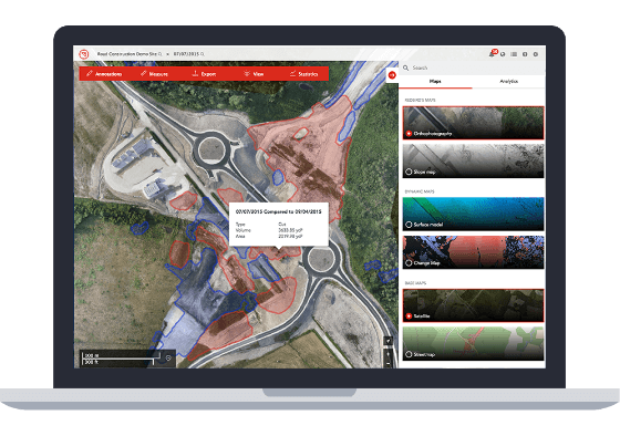
This means that any employee can get high-resolution data on the entire site and visualise the relevant information easily. Using the simple web interface, analytics can be extracted to produce real-time reports about production, productivity or safety.

Using this information, better decisions can be made faster, increasing the overall productivity of a jobsite.

We offer Airware aerial surveying as a stand-alone or modular solution. Our modular approach allows customers to bring together information from Airware surveying, our equipment monitoring solutions, maintenance data and more.

With support from our expert team, this approach gives a much fuller picture of how a site is operating and where improvements can be made.
Benefits for Construction

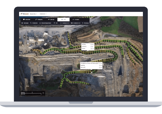
  • Monitor job progress. Measure excavation and fill material volumes. Optimise imported material quantities and cost. Track construction progress against project plan. Compare design plans to as-built. Extract road network analytics to optimise machine fuel consumption and traffic. View data in local/custom coordinate systems.
  • Survey your design faster in higher definition. See enormous differences in speed, resolution, and coverage in your site surveys. Create fresh job site maps rapidly and repeatedly.
  • Collaborate easily across sites and teams.  Scale across organisations and operations of any size. Browser-based application allows universal access by anyone, anytime, anywhere. Annotate, comment and share with all your collaborators.

Benefits for Quarrying, Mining and Other Industries

  • Monitor production and efficiency. Visualise inventory and export reports to Excel format. Measure reserve consumption and mining progress. Analyse haul road conditions to optimise fleet fuel consumption and traffic flow. Plan blasting and track changes over time.
  • Help ensure safety and compliance. Detect non-compliant safety blocks, berms, and highwalls. View impact areas. Conduct safety reviews more comprehensively and frequently to ensure safe operating conditions.
  • Collaborate easily across sites and teams. Scale across organisations and operations of any size. Browser-based application allows universal access by anyone, anytime, anywhere. Annotate, comment and share with all your collaborators.

Want to Talk?

Contact us today at 00 44 800 028 7778 or call your Finning representative.


This field is required. This field is required. This field is required. This field is required. This field is required.
We would like to send you offers and news about Finning and Caterpillar products and services. To join our mailing list please tick the box below.