Turn aerial data into business insights
As part of our technology driven solutions for the construction, mining and quarrying sectors, we are a dealer for cloud based aerial survey specialist, Airware.
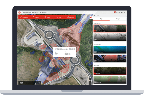
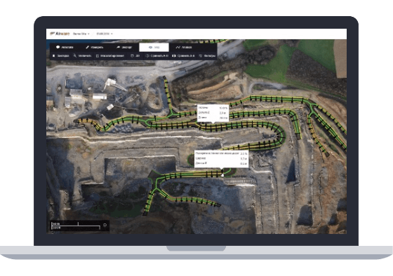
By carrying out flights by unmanned aerial vehicles (UAV’s), commonly known as drones, trained operators can gather advanced surveying data across large areas, in a matter of hours.
This data can then be transferred online and transformed into valuable production tracking and site assessment information, using Airware's cloud–based automatic processing software. Accessed from a full range of connected devices, this powerful information can be shared online with your teams and our experts.
This means that any employee can get high-resolution data on the entire site and visualise the relevant information easily. Using the simple web interface, analytics can be extracted to produce real-time reports about production, productivity or safety.
Using this information, better decisions can be made faster, increasing the overall productivity of a jobsite.
We offer Airware aerial surveying as a stand-alone or modular solution. Our modular approach allows customers to bring together information from Airware surveying, our equipment monitoring solutions, maintenance data and more.
With support from our expert team, this approach gives a much fuller picture of how a site is operating and where improvements can be made.